
Aqueduct
The Secret Aqueduct in Ruislip
Did you know there was an aqueduct in Ruislip?
You can read all about the canal feeder itself here
So where is the aqueduct? How to find the aqueduct (is actually quite easy to find......)
Proceed down Sharps Lane from Bury Street, this road becomes Hill Lane. Turn right in to Orchard Close and follow it to, almost, its end where it crosses the River Pinn by way of a small footbridge. Just before the footbridge, on the left, Woodville Gardens will be seen. Proceed all the way down this road to the end, where it finishes at a gate blocking the entrance to a field.
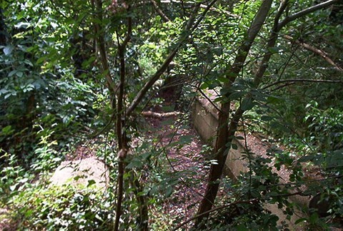
Pass through the gate and turn sharp right. Through the grass a "path" of sorts can be seen leading to a wooded area, where this becomes more defined in to the woods. The aqueduct is just in to the wooded area.
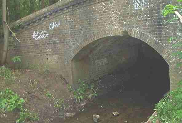
The pictures are from June 2004. If you have more recent ones we would be pleased to have them.
On the map below look where the River Pinn crosses with another blue line running at 90 degrees to it. That is the site of the aqueduct.
Conducted by Denise Shackell.
"The feeder is piped under Bury Street to the field opposite, then is open across the field to Howlett's Lane, where the feeder is again piped at an angle beneath the road to a good path on the opposite side of the road. The path, with Whiteheath School on the left, has two small bridges made of brick that cross the feeder, one of which is dated 1930.
"On reaching a field, The Tile Kiln Lane house roofs can be seen to the right. At the end of this field there is an aqueduct, of which about thirty feet is still in good condition, built to cross the River Pinn.
Proceed down Sharps Lane from Bury Street, this road becomes Hill Lane. Turn right in to Orchard Close and follow it to, almost, its end where it crosses the River Pinn by way of a small footbridge. Just before the footbridge, on the left, Woodville Gardens will be seen. Proceed all the way down this road to the end, where it finishes at a gate blocking the entrance to a field.
Pass through the gate and turn sharp right. Through the grass a "path" of sorts can be seen leading to a wooded area, where this becomes more defined in to the woods. The aqueduct is just in to the wooded area.
More pictures of the Aqueduct are here including some of the trough that went over the top (such as it is now).